

Rainer Simon
,@rsimon
2
Following
4
Followers
-

John Levin started the topic High Quality 17th and 18th century maps of London in the discussion
 Open-source historical mapping on Humanities Commons 9 years, 1 month ago
This is a list of high quality, freely downloadable, freely reuseable maps of seventeenth and eighteenth century London, suitable for georectification and for use in the map hackathon. I will be working on geo-rectifying these over Christmas, but doubt I will get all done.
An exact survey of … London after the Great Fire
From the New York…[Read more]
-
Colin Greenstreet started the topic Use of pinterest as a discovery tool for map and image mapping sources in the discussion
Open-source historical mapping on Humanities Commons 9 years, 1 month agoI kicked off a MarineLives experiment today by creating a #maphackathon pinterest board, and publicising it on Twitter. It will be interesting to see if it acquires any followers and develops a creative life or is just a “good idea” which goes nowhere. As of 12.21 Wedneday December 7th 2016 it had eleven pins (all seeded by me) and had acquired…[Read more]
-
Colin Greenstreet replied to the topic Spatial experiment at #maphackathon, Feb 10/11 2017 (TBC) in the discussion
Open-source historical mapping on Humanities Commons 9 years, 1 month agoProvisional goal of #maphackathon spatial experiment:
To build a river-centric analysis of commercial life in C17th and early C18th London and surrounds, using diverse text, numeric, visual and map data sources supplied or hacked by #maphackathon attendees. Visualisations to combine topographical, occupational and event/movements data; c…[Read more]
-
Colin Greenstreet replied to the topic CFP of potential interest to the group in the discussion
Open-source historical mapping on Humanities Commons 9 years, 1 month agoPosted the CFP to @marinelivesorg Twitter account. As of 13.34 UK time, Tues Dec 6th 2016 seven Retweets
-
Colin Greenstreet started the topic Linked open data from MarineLives semantic media wiki for experimentation in the discussion
Open-source historical mapping on Humanities Commons 9 years, 1 month agoThe MarineLives project uses a semantic media wiki as its platform to view and transcribe manuscript images, to annotate transcribed pages, and to create semantic biographies. All semantic biographies contain geographical location data. For example, semantic biographies for the hamlet of Limehouse in the parish of Stepney in the county of Middlesex…[Read more]
-

Nicky Agate started the topic CFP of potential interest to the group in the discussion
Open-source historical mapping on Humanities Commons 9 years, 1 month agoCoordinates: Digital Mapping and 18th C Visual, Material, and Built Cultures
Art history’s digital turn has been stimulated by the possibilities of spatial research. Spurred by the collection, preservation, and distribution of art historical data in digital space—practices that have both collapsed and expanded our own discursive geog…[Read more] -
Colin Greenstreet replied to the topic Spatial experiment at #maphackathon, Feb 10/11 2017 (TBC) in the discussion
Open-source historical mapping on Humanities Commons 9 years, 1 month agoAccess to full set of Tweets as we shape the #maphackathon
Twitter is a powerful tool and we are using it actively to shape the proposed #maphackathon
Click here to access the top #maphackathon tweets and images.
Click here to access the full set of #maphackathon tweets and images.
-
Colin Greenstreet replied to the topic Spatial experiment at #maphackathon, Feb 10/11 2017 (TBC) in the discussion
Open-source historical mapping on Humanities Commons 9 years, 1 month ago#maphackathon datasets on Google drive
We have manually extracted data on English ship movements from witness statements in the English High Court of Admiralty in the 1650s. These data include port departure and arrival dates, allowing computation and visualisation of travel times, dwell times and routes. Data cover ship voyages between 1645…[Read more]
-
Colin Greenstreet started the topic Spatial experiment at #maphackathon, Feb 10/11 2017 (TBC) in the discussion
Open-source historical mapping on Humanities Commons 9 years, 1 month agoWe are organising a Friday evening and Saturday morning of spatial experiment #maphackathon in central London on Friday February 10th and Saturday February 11th 2017. We encourage all readers and members of this group to contribute their ideas and to help shape the event.
Datasets will be made available in advance by @marinelivesorg and @cgspen…[Read more]
-
John Levin replied to the topic The use of QGIS in historical mapping in the discussion
Open-source historical mapping on Humanities Commons 9 years, 1 month ago -
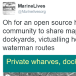
Colin Greenstreet replied to the topic How can we find and map C17th Thames shore warehouses? in the discussion
Open-source historical mapping on Humanities Commons 9 years, 1 month agoTwitter exchange with Dr Craig Spence, Saturday December 3rd 2016
Post @Marinelivesorg: Missing Thames infrastructure – Ideas for datamining text/archaeological records to find & map C17th Thames warehouses? #maphackathon
Post @cgspence: @Marinelivesorg my book ‘London in the 1690s’ incs map locating taxed warehouses vaults etc. 4s A…[Read more]
-
Colin Greenstreet started the topic Where were the twelve mooring chains in the River Thames? in the discussion
Open-source historical mapping on Humanities Commons 9 years, 1 month agoPrimary sources
E 367/5903. Burrell: Mooring chains and dues in the river Thames between Bugby’s Hole and London Bridge. Date: 22 Geo.III.
Report from the committee appointed to enquire into the best mode of providing sufficeint accomodation for the increased trade and shipping of the port of London (London, 1796)
“Appendix…[Read more]
-
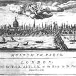
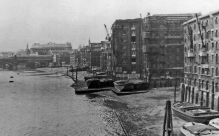
Colin Greenstreet started the topic How can we find and map C17th Thames shore warehouses? in the discussion
Open-source historical mapping on Humanities Commons 9 years, 1 month agoWhat text and archaeological records exist which we could make use of in constructing a map of mid-C17th Thames shoreline warehousing?
No comprehensive study or map have been made of C17th warehousing and other commercial marine infrastructure on the north and south shores of the Thames from London Bridge down to Woolwich. Morgan’s 1682 map…[Read more]
-
Colin Greenstreet started the topic The use of QGIS in historical mapping in the discussion
Open-source historical mapping on Humanities Commons 9 years, 1 month agoQGIS is a free open-source Geographical Information System (GIS). It has been developed and is supported by the OSGeo Foundation. The latest version is QGIS 2.18 Las Palmas. It is available for download here.
The development and release history of the system is described in a wikipedia article on QGIS.
The product runs on Linux, Mac OSX,…[Read more]
-
-
Colin Greenstreet created the group
Open-source historical mapping on Humanities Commons 9 years, 1 month ago